Quick heads-up: some of the links on this page are affiliate links. If you make a purchase through them, we may earn a small commission (at no extra cost to you). This small bit of income helps keep our site running.
Semaphore Lakes Trip Report and Hiking Guide

This trip report was last updated on December 21, 2023.
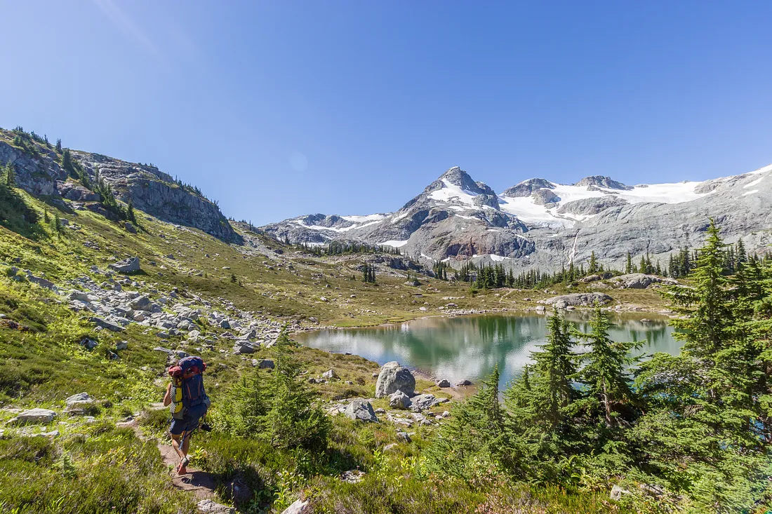
Semaphore Lakes is a quick hike with a huge payoff. You quickly ascend up in to the alpine, where you have a ton of camping options on several different lakes. There are some great day hikes to do up a couple different peaks, or if you're looking for something a little more mellow, a nice waterfall near camp. If you haven't been to Semaphore Lakes yet, it should be high on your list of places to see.
Quick Facts
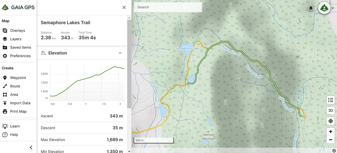
- Distance: 2.4 km to the lake
- Elevation: 340 meters to the lake
- Time: About 1 hour to the lake
- Best Time of Year: July to September
- Access: 2WD will get you to the trailhead
- Difficulty: 2/5. This is an easy hike on a good trail, with just a bit of elevation. If you end up trying any of the peaks in the area then the difficulty goes up a bit.
Essential Gear
- Backpacking Towel: With three different beautiful alpine lakes to choose from, Semaphore Lakes is a great chance to take a dip in an alpine lake. There's a not trivial amount of elevation to gain when backpacking in to the lakes, so do yourself a favor, bring a backpacking towel and go for a little dip to wash the sweat off before bed.
- Backpacking Chair: A short hike in means you'll probably have some down time around camp. I think one of the best luxuries while camping is a backpacking chair. Some of the best ones are very lightweight, don't take up much room, and you can spend hours lounging in them.
- Down Jacket: Semaphore Lakes sits at just under 1700 meters elevation, so no matter what time of year you go, it's going to get a little chilly at night. A good quality down jacket packs down small and provides a huge amount of warmth. It's the perfect thing to throw in your backpack for those couple of hours after the sun goes down but before you want to go to bed.
Directions to the Trailhead
This is a pretty easy hike to get to. You head to Pemberton, and then head up the Pemberton valley to the Hurley FSR (forest service road). Once on the Hurley you drive for about 15 minutes, or 10 kilometers, and the trailhead will be on your left.
There is a bit of a pullout, and on any given weekend you should see some other cars parked there as this is a popular area. Here is a Google maps link for the trailhead.
The Hurley is a gravel road that is typically in good condition, though it's not uncommon for vehicles to get flats from driving the Hurley, so this is a good trip to make sure you spare tire for. A Jeep in my group got a flat, so it's not just the 2WD cars that have to watch out.
The Hike to Semaphore Lakes
Once at the trailhead, you head down in to the brush, cross a bit of a marshy section and then you start ascending.
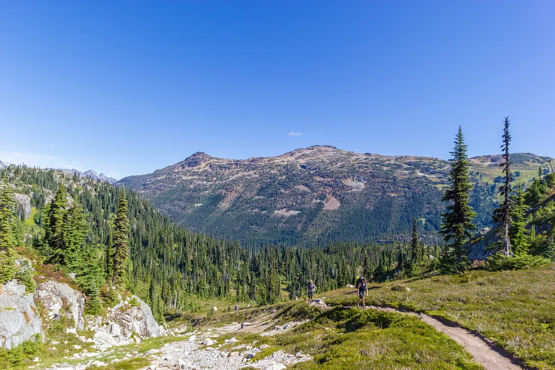
The trail follows Railroad creek for the first 2 kilometers or so up through a pretty valley in the trees. At some point you exit the trees and come out in to more of an alpine environment. You'll have a long, straight ascent up a hill in front of you. This is the last of the significant elevation.
Camping Options
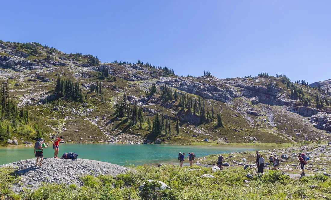
Once you're up in the area of the lakes you have a lot of different camping options, and you might see tents anywhere. But most people tend to head for one of the lakes.
The middle lake is pretty and has some good camping ground around it. It's definitely a recommended spot. You can see it in the top picture of this post.
The top lake is another good choice if you're wanting to head up to either Face Mountain or Locomotive Mountain, as you wont have to walk as far to get back to your camp.
The bottom lake is nice too, but is a bit out of the way (it's down towards the bottom of the last big hill you come up on your hike in). If you're looking for a more secluded option, the bottom lake might be a good choice.
Semaphore Lakes is a popular spot for camping due to the easy access, so you may need to get there a little early on a warm summer weekend to snag a good spot. But there are plenty of camping spots that aren't near the lakes.
Nearby Mountains and Scrambles
If you're looking to venture beyond camp there are a few different things worth checking out.
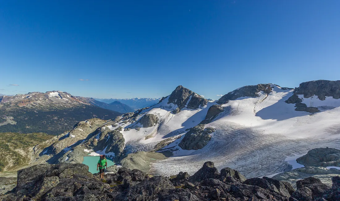
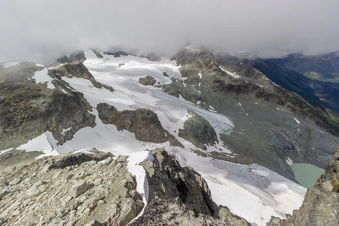
Glacier Lake
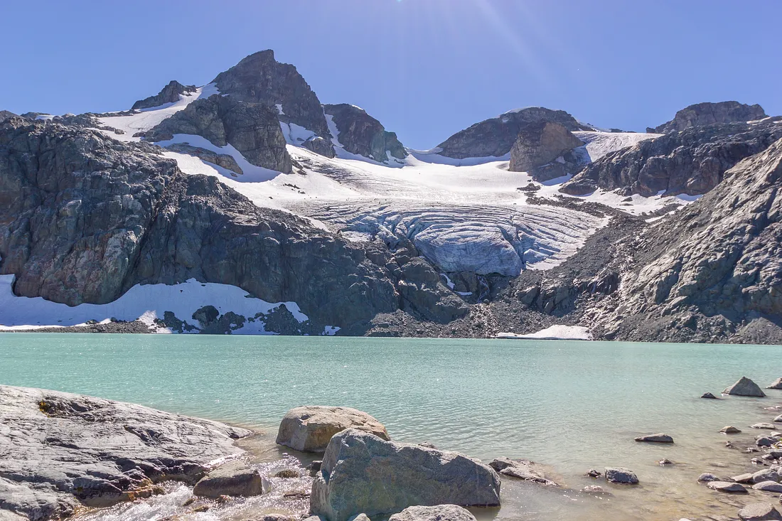
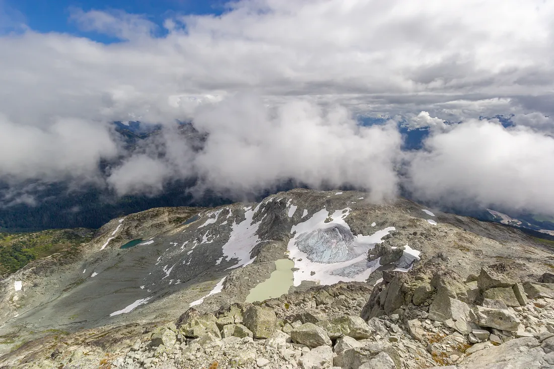
Just West of the top lake you will be able to see a small river coming down the rock slabs from above. The small river is fed by a large, glacial lake that sits up above. If the hike in from the trailhead wasn't quite enough of a challenge, this upper lake is a quick hike from camp.
To get to the lake, the best route is to go up to the right of the outflow river, hiking up boulders and scree, until you get up to about the elevation of the lake. From there you can cut across to the lake itself.
Locomotive Mountain
(From the middle lake, it's 3.7 km and 670 meters of elevation gain to the peak)
Locomotive mountain is a high quality easy scramble with a couple moderate steps. If you're trying to decide between this and Face Mountain, this is the easier of the two.
From the middle lake you start out south, aiming for the ridge that wraps around down from the peak of Locomotive. Once you pick up the trail, it's a fun hike to the top, following the ridge as it wraps West and then North up to the peak.
You get some excellent views from here.
Face Mountain
(From the middle lake it's 3.4 km and 840 meters of elevation to the peak)
Face Mountain isn't all that hard in terms of scrambling but there is some not so obvious route finding if you want to make it to the top without doing any hard scrambling.
From the middle Semaphore Lake you head West, aiming for the rocky slopes just to the right of the small river coming down the granite slabs.
From there you have a couple options. You can ascend on to the obvious Eastern ridge, or stay lower down, in the basin where the glacier is, skirting the bottom edge of the ridge.
If you've ascended to the ridge you'll want to leave it when it gets steep, and traverse across to climbers left, to a ramp that is a fair ways across the face of the mountain.
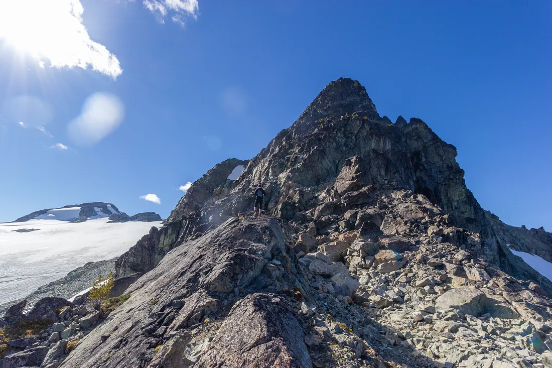
If you stayed down low, you'll have a steep ascent up some loose rock where the rocky steepness of the ridge gives way, and you'll follow that same line up and to the left to the same ramp mentioned above.
Once you're on the ramp, you can follow that all the way to the summit, with no more than some moderate scrambling involved. If you find yourself ascending a ramp or couloir that seems particularly hard, you probably didn't go far enough across the face of Face Mountain.
Train Traverse
(From the middle lake it's an 11km loop, with 1190 meters of elevation gain)
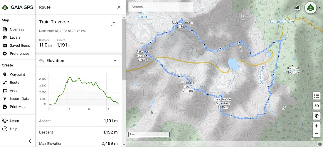
If you want to really get an adventure in then the Train Traverse is fantastic. It enchains Face Mountain, Faceless Mountain, Caboose Peak and Locomotive Mountain, following the mountain ridge the entire way and losing a minimum amount of elevation.
It's mostly moderate scrambling and straight-forward hiking, with one hard scramble section where you'll have to use your hands.
This can certainly be done as part of a camping trip to Semaphore Lakes, but if you want to just do a day hike in to the area and want to get as much value as possible, this would be a good objective.
FAQ
Are there any bears at Semaphore Lakes?
Yes, there are definitely bears in the area. Semaphore Lakes is far enough north that there is also more of a chance of seeing a grizzly than there is further south, in the Squamish or Whistler area. I've heard of at least one Grizzly bear spotted in the Semaphore Lakes area, and I'm sure it wasn't the only one. Bears are typically not something you need to worry overly much about, as long as you have good bear spray and you keep your food away from the bears, by either storing it in a bear canister or hanging it.
Can I bring my dog?
Yes, since Semaphore Lakes is not part of a park, you are free to bring your dog. If you're comfortable with your dog being off-leash you can do that too.
What is the best time of the year to hike Semaphore Lakes?
July through September is when most people will go to Semaphore Lakes. Before July there's a decent chance you'll encounter snow, especially higher up on Locomotive Mountain or Face Mountain, though this will depend on the snow pack that year. After September it will get cold, and the chances of getting rained on (or snowed on) go up a fair bit.
How bad are the bugs?
There is a good amount of standing water in the Semaphore Lakes area, so bugs and mosquitos will be worse than average. If it's a bad bug year, definitely bring bug spray.
Do I need a permit?
No, the Semaphore Lakes area is on crown land, and not part of any park, so you don't need any kind of permit to camp there.
Can I have a fire at Semaphore Lakes?
Yes, you can have a fire provided that there isn't a fire ban currently on for the region. Please also try to bring your own wood. Semaphore Lakes is an alpine environment with limited number of trees. The trees grow very slowly in the alpine, and if everyone uses the trees to make fires, there won't be any trees left.
Gear Packing List
Sleeping + Shelter
- Sleeping bag
- Sleeping pad
- Pillow
- Tent
- Tent pegs
- Tent footprint
Cooking + Eating
- Stove
- Propane (or other fuel source)
- Lighter
- Pot and / or Pan
- Bowl / Plate
- Spork
- Biodegradable dish soap
- Breakfast
- Lunch
- Dinner
- Snacks
- Coffee (or tea)
Water
- Water bottle
- Water filter (the lake water is relatively clean, so purification tablets will work too)
- Mug for hot drinks
Packing
- Backpack
- Backpack rain-cover
- Zip-locks and / or trash bag
- Food storage bag
- Bear Canister or hanging system
Feet
Hygiene
- Toilet paper
- Toothbrush + toothpaste
- Soap (make sure it's biodegradable)
Clothing
- Underwear
- Long underwear
- Base layer
- Down jacket and / or fleece
- Shirts
- Shorts or Pants
- Rain jacket (if the weather calls for it)
- Rain pants (if the weather calls for it)
- Hat
Around Camp
- Headlamp (plus extra batteries)
- Backpacking chair
- Backpacking towel (if you're thinking about taking a dip in one of the lakes)
- Knife
Misc
- Trekking poles
- Sunglasses
- Camera
- Cord or rope
- Bear spray
- First aid kit
- Mosquito spray
- Sunscreen
- Duct tape